

By Yetunde Adesiyan
Urban planning expert Yetunde Adesiyan has stressed the urgent need to deploy Geographic Information Science (GIS) in addressing the mounting pressures of rapid urbanisation, particularly in Lagos.
According to her, advanced tools such as Urban Change Detection and Machine Learning Techniques can guide authorities in identifying optimal sites for new roads, ultimately strengthening the city’s transportation network.
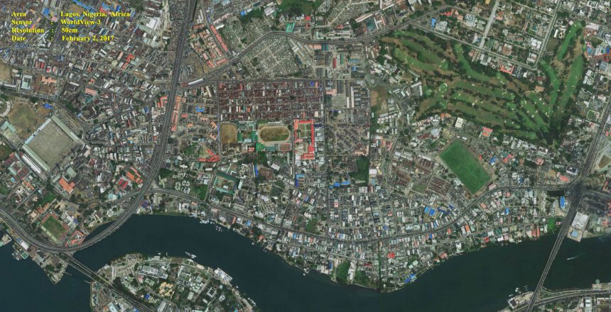
“Lagos is Nigeria’s largest urban centre and one of the fastest-growing megacities globally, with its population estimated between 12 and 20 million,” she noted. “Given this pace of expansion, it is critical to analyse how the city is evolving over time and to apply that knowledge to infrastructure planning.”
Adesiyan explained that urban change detection a technique that compares satellite images captured at different periods enables planners to track how landscapes are transformed by development. By interpreting these changes, she argued, policymakers can make informed decisions on land use, resource allocation, road construction, and environmental management.
She pointed out that a data-driven approach is essential as Lagos continues to sprawl outward. “Population growth brings increased building footprints and heightened demand for mobility. If roads are planned with urbanisation trends in mind, it is possible to ease traffic congestion, improve accessibility, and reduce negative environmental impacts,” she said.
Highlighting the practical benefits, Adesiyan added that effective road planning also requires assessing factors such as proximity to settlements and compliance with zoning regulations. “By aligning road construction with spatial data, traffic can be better distributed, congestion reduced, and the overall efficiency of the city’s transport system enhanced,” she said.